Six Mile run
Reservoir? But Where's the Water?
Along South Middlebush Road in Franklin Township is a unique resource – a cultural landscape dating back to the colonial settlement of the area in 1702. From a hill top farm along Skillman’s Lane, a farmland vista unfolds toward the Delaware and Raritan Canal and the Millstone River beyond. Not a strip mall, food establishment or subdivision is in sight. Instead, on the hills above Blackwells Mills Road is a glimpse into a past time, an undeveloped rural landscape and the remains of farmsteads and outbuildings that are relics of the Dutch pioneers who settled this area that we now call The Six Mile Run Reservoir Site.
The name might confuse those park visitors expecting to find a large body of water and the associated recreational activities that usually accompany a reservoir. If you’re looking for boating, swimming, fishing or even lakeside camping, you’ll be disappointed to learn none are available here. As the name implies, Six Mile Run is the “site” of a proposed reservoir; a site that until now has not been constructed.
But why build a reservoir? The need to supply water to NJ’s rapidly growing population in the 1950s was identified as a hot issue by our state leaders after the state suffered drought in 1953. A reliable source was needed and discussions quickly turned to reservoir building. Several locations were identified as suitable including the large farming community surrounding the Six Mile Run (a natural stream located 6 miles from the colonial settlement at New Brunswick and so named by the early 17th century settlers). The others were the populated farming communities we now know as Round Valley and Spruce Run Recreation Areas. Both the Round Valley and the Spruce Run projects pre-dated Six Mile Run and although plans were well underway in the 1960s and properties were purchased to make way for the new water supply, the Six Mile Run site was eventually tabled. As it turned out, the reservoirs at Round Valley and Spruce Run, as well as the waters of the D & R Canal, proved to provide adequate supplies of water for those in the northeastern and central area of the state at that time. The Six Mile Run reservoir was not yet needed and so the 3000+ acres that now belonged to the state were turned over to the Division of Parks and Forestry in the 1990s to be managed as open space and parkland until such time that the proposed reservoir was deemed necessary; something not likely to happen, according to the state, for several more decades.
Displacement
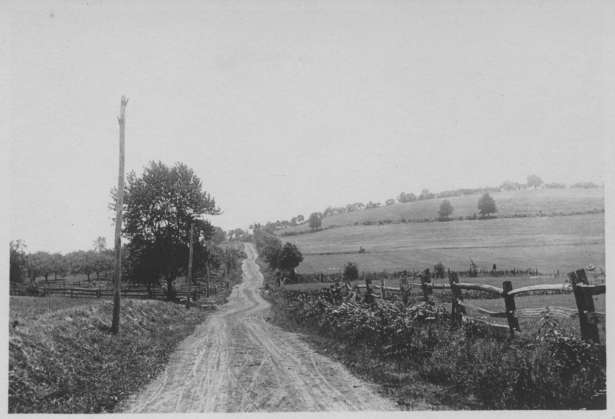
Creation of a reservoir is usually fraught with controversy and such was the case for the Six Mile Run site even though the run was never dammed nor the farmland flooded. Many families lost their ancestral homes as the state bought out privately owned properties and a total of 3000+ acres in preparation for the proposed reservoir. Several property owners were descendants from some of the original owners who date back to the early seventeenth century. Many others had purchased their properties decades earlier with little desire to sell to the state. Yet despite an efforts by those affected and a concerned community, the properties were slowly sold. Some owners opted to stay and lease their former homes and farmland for a time from the state. In other cases families moved on leaving only the structures and farmed landscape behind. The ghosts of many of those farmsteads can still be seen dotting the landscape. They stand as testament to those who called this “Pleasant Valley” their homes. The pristine landscape and the architectural remains of those structures can be seen by those hiking and biking the trails of the Six Mile Run Reservoir site today.
History of the Area
The colonists, who settled the area and built the first phases of some of the surviving structures can be found without looking very hard. Their names have survived into the 21st century and are printed on street signs that cross through the Six Mile Run area: Cortelyous, Jacques, Suydam, Skillman, Vliet, Van Cleef. Some names never made it to street signs but their influence on the agricultural landscape was no less significant: Polhemus, Vanliew, Nevius, Hagemen, Wycoff, Voorhees. These names are connected through culture and heritage as many were of Dutch origin. The first Dutch landowners from Staten Island purchased their extensive land tracts in 1702 from John Harrison – an early land speculator. Those 10,000 acres were subdivided into 16 lots by Jacques Cortelyou. The land was extensive running east to west from today’s Route 27 to the Millstone River. The 10,000 acre tract was split down the middle and 8 lots were laid on each side. The dividing line became South Middlebush Road. Those landowners were Jacques Cortelyou, Peter Cortelyou, Theodorus Polhemus, Garritt Stoothoff, Cornelius Wycoff, Hendrik Lott, Cornelius Van Wyckoff, Frederick Van Liew, Stoffel Probaskoo and Deneys Tennisson; Names that have endured into the 21st century.
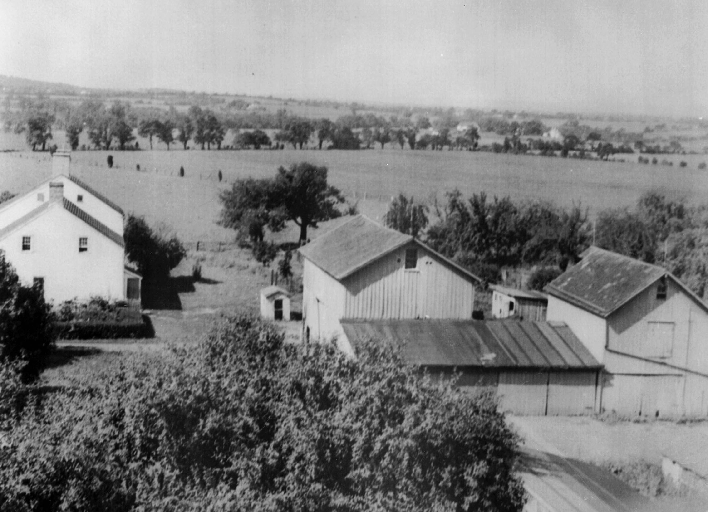
Settlement was gradual as some held onto the land for speculation or to pass to their sons as inheritance. One of the earliest homesteads is the Wyckoff-Garretson house that was built by Cornelius Wycoff’s son John who moved to the area around 1710 and began the difficult process of tilling the land and establishing a farmstead. That 1730 Dutch style home has been restored and is maintained by the Meadows Foundation. As are two other Six Mile Run properties also restored and maintained by the Meadows Foundation - the Hageman House and the Vanliew/Suydam House. Each house has its own unique story but the Hageman House and Farm which also dates to the 1700s is worth mentioning because it was owned by only two families for over 200 years before being sold to the state – the Hagemans and Garretsons - both of Dutch origin. It is an example of the longevity of ownership that permeated the Six Mile Run district.
The three Meadow Foundation houses are examples of farmsteads that have been successfully restored and adaptively reused. Others that trail users might encounter while at the Six Mile Run site have not fared as well including the imposing J.J. Voorhees House, the Polhemus Farmstead, the Wyckoff Farm and the Dmuchoswki property to name a few. Abandoned and no longer in use, these structures are exposed to the elements and vandals. With limited resources, the State is unable to restore, reuse or staff these structures. While demolition through neglect is the likely outcome for the abandoned built environment of the Six Mile Run site, the upside is the preservation of the land from development. Had the 3000 acres not been purchased by the state in the 1960s and 70s, much of what is now open space would be dotted with homes, condos, supermarkets and strip malls.
Farming
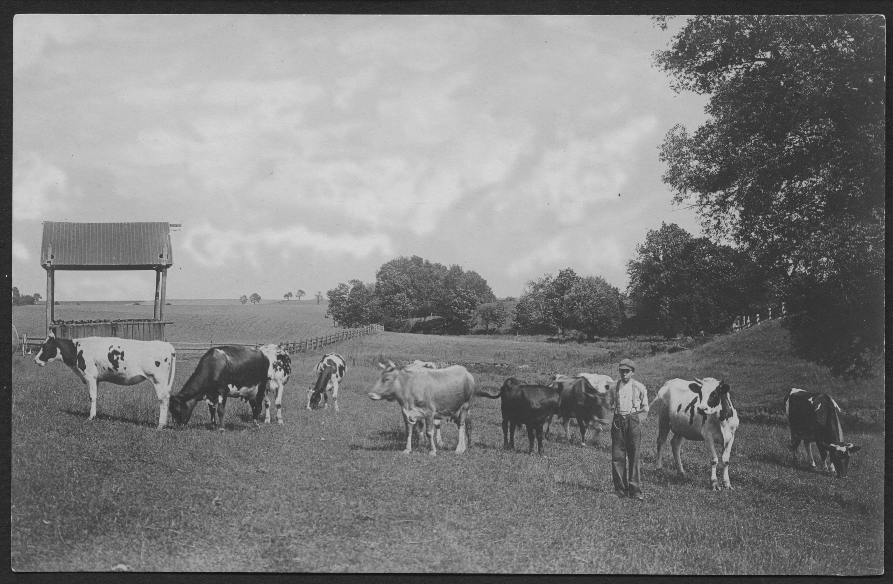
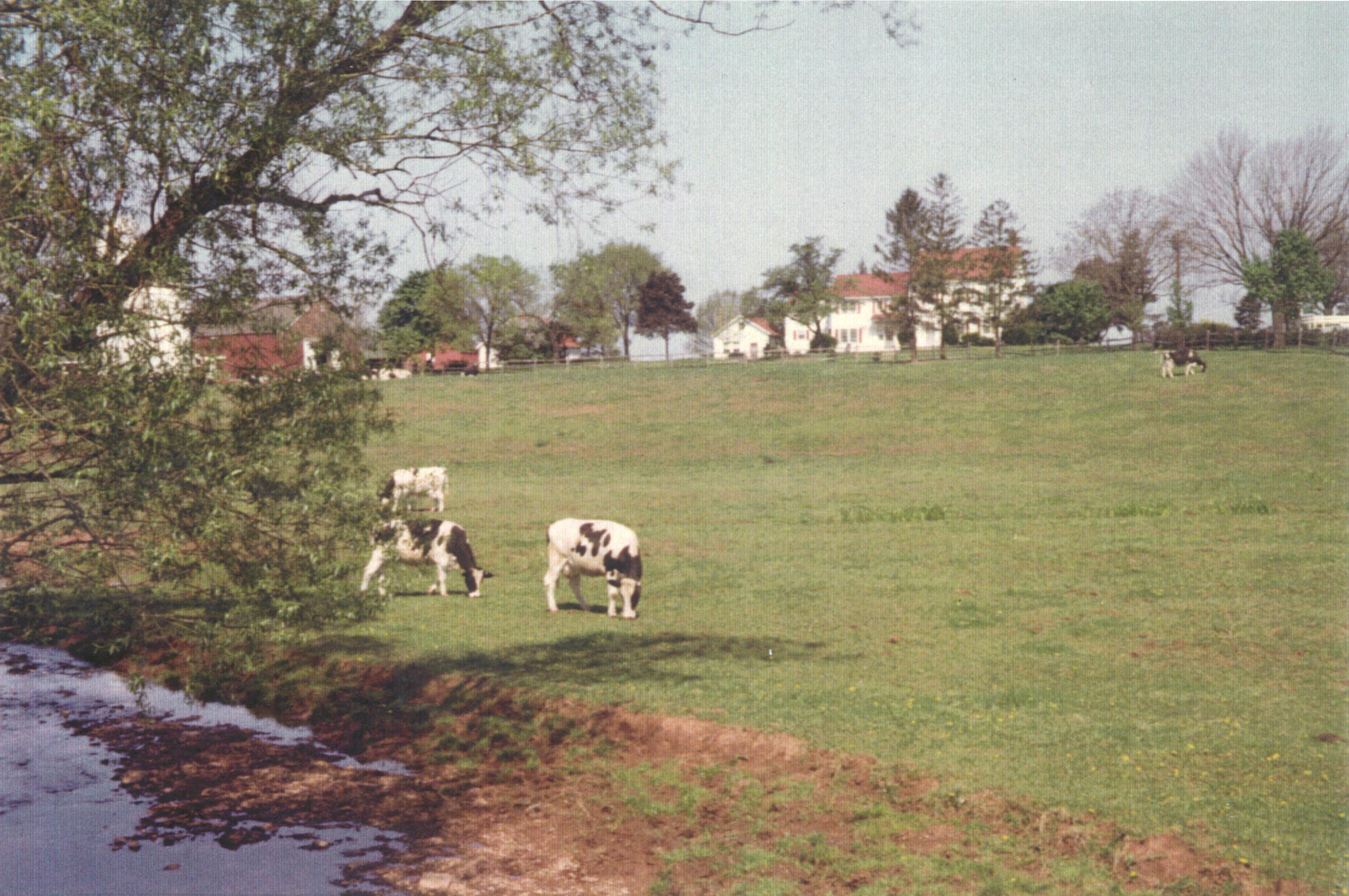
Above all, the Six Mile Run district was predominately agricultural and the surviving landscape with its open fields, rolling hills and forested wood lots, hints strongly of that past. This was acreage where the people made their livelihoods from tilling the soil, raising livestock, cultivating orchards, running dairies and harvesting wheat, rye, oats and a variety of produce. These activities continued into the twentieth century and up until the state earmarked the land for a reservoir in the early half of the century. The state stepped in before the era of large scale development hit its prime. It does seem clear that had the land not been eyed by the state, developers would not have been far behind in an effort to sway farmers from the land with large payouts. Slowly land would have been bought up, farmers bought out and the vistas we now enjoy would be pot-marked with box stores, subdivisions, condos, shops and acres of small strip malls. Instead the landscape has been preserved and continues to be farmed through land leases with local farmers and dairymen. It is a time capsule, a throw-back to the days when the state earned the moniker “The Garden State.”
Trail Building & Recreational Use
Three pilot trails offering 7 miles of hiking, biking and horseback riding officially opened to the public in the Spring of 1998 after several years of planning, trailblazing and unofficial access. Not unlike the rest of the Six Mile Run story, these trails were not implemented without their fair share of controversy.
Although the open space tract was handed over to the Division of Parks and Forestry in the early 1990s to be managed for public use, farmers, who for years leased a large percentage of the Six Mile Run fields, objected to the idea of trails skirting along and adjacent to their cultivated lands. Fears of trespassing, crop damage and liability issues were among their chief concerns. Despite these issues, the park staff along with local friends organizations began work in 1995 to layout and plan the paths that would become the first open trails to crisscross the historic landscape. At the same time discussions and public meetings were held in order to bring all sides to the table until agreements were reached and the pilot trail project could be successfully launched with the blessing of all involved.
It has been several years since the opening of official public recreational use at the Six Mile Run Reservoir site and in that time this preserved landscape has been discovered by many outdoor enthusiasts. With the help of JORBA, an off-road biking non-profit organization, the multi-use trail system has been improved and grownto just under 17 miles of trails. On any given day one is likely to see birders, bikers, hikers and horseback riders sharing the trails and enjoying the open fields and wooded paths.
Conclusion
It has been over 300 years since colonial settlement of the land now referred to as Six Mile Run. In that time this rolling landscape has been tamed, cultivated and built upon by the generations of people who set down roots here. The evidence of their inhabitance dot the landscape from the shells of their homes, outbuildings and cemeteries to the acres of agricultural fields now maintained and cultivated by a new generation of farmers. For the time being the landscape has been preserved and saved from development. Much of the land is still being put to its historic use through agriculture and a small portion can be used and enjoyed by the public – a happy compromise. It is an oasis surrounded by suburban sprawl. It will be decades before discussions of flooding this tract of land are brought back to the table. In the mean time discussions for an alternate site are not unlikely and the Six Mile Run Reservoir Site, listed as an Historic District on both the State and National Register of Historic Places registry, will likely remain an untouched agricultural and cultural landscape for the benefit of all.