The historic towpath along the main canal from Bakers Basin Road (Trenton) to New Brunswick has a natural surface for hiking, jogging, horseback riding, and biking. From Mulberry Street to Bakers Basin Road, the trail is crushed stone. Horse trailers may be parked in some of the parking areas located along the main canal. The trail along the feeder canal is made of fine textured crushed stone and is for hiking, jogging and biking. No horses are permitted on the feeder canal trail. Motorized vehicles or ATV's are not permitted on trails in the park.
Use the buttons below to view maps of our trails.
Click on the "i" icon in the lower right corner of each map for more information.
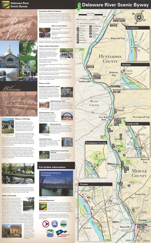
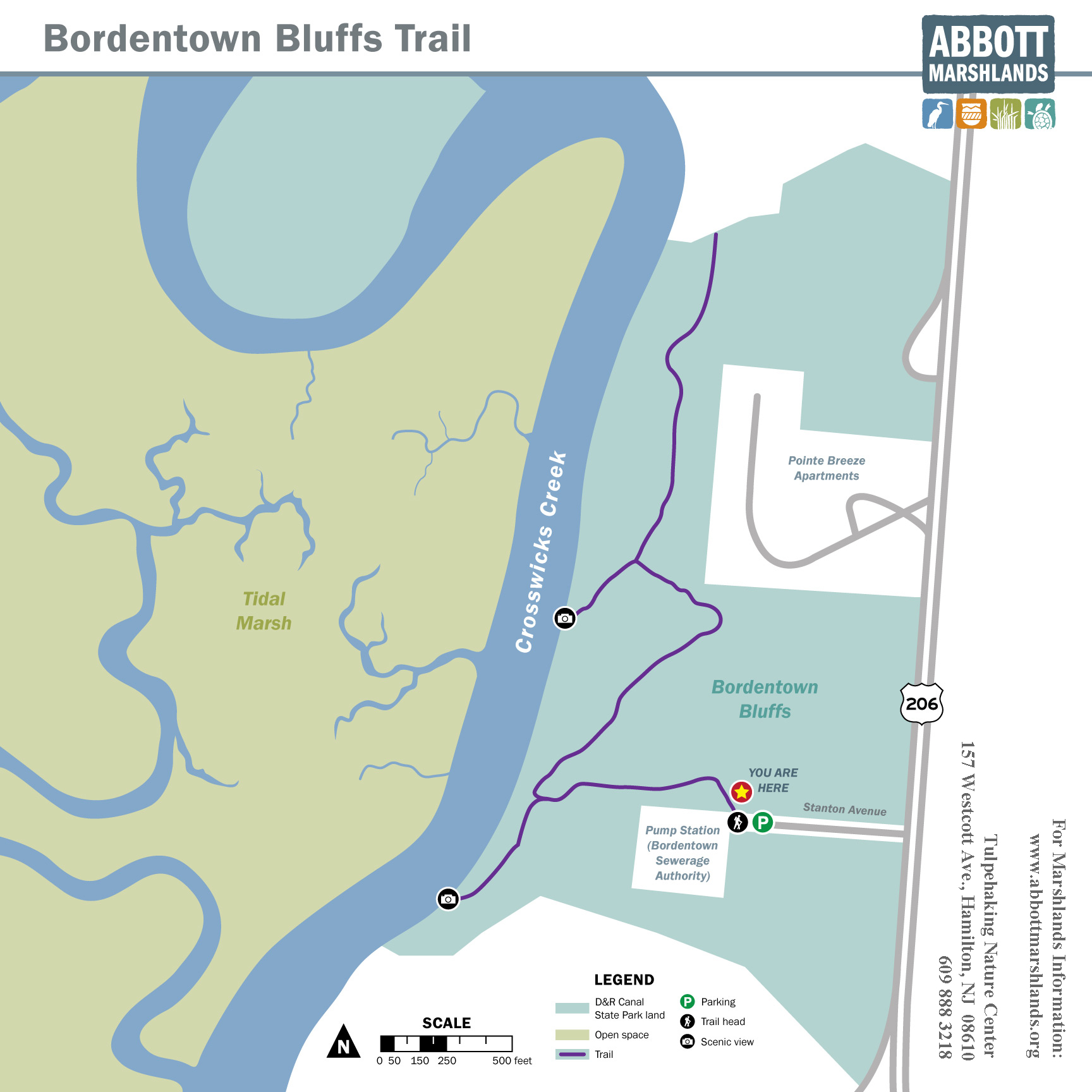
The 70-mile Delaware and Raritan Canal State Park is one of central New Jersey's most popular recreational corridors for canoeing, jogging, hiking, bicycling, fishing and horseback riding. The canal and the park are part of the National Recreation Trail System. This linear park is also a valuable wildlife corridor connecting fields and forests. A recent bird survey conducted in the park revealed 160 species of birds, almost 90 of which nested in the park. The trail is located on lands owned by the New Jersey Department of Environmental Protection, administered by the New Jersey State Park Service, and maintained by the Delaware Township Environmental Commission with help from volunteers. Visitors are welcome from dawn to dusk. Northern Community Park is located on Groveville Road between Route 206 and Route 130 in Bordentown Township. The trail starts from a recreation area of baseball diamonds, tennis courts, playground and restrooms near the parking lot. This short trail highlights towering tulip poplars, beech and oak trees leading to a wetland area filled with lycopodium and ferns. This access point is accessible from Route 206 South in Bordentown Township, south of the I-195 interchange. From Route 206 South, turn right onto Stanton Avenue, which is the first right past Pointe Breeze Apartments. Please do not park in front of either gate. The trail runs along the top of a bluff, which overlooks the Abbott Marshlands and Crosswicks Creek. The oak woods on the top of the bluff are dominated by White, Chestnut, and Black Oaks with numerous Tulip Poplars and Black Gums. On the bluff itself, and as undergrowth in the older part of the woods, are dense thickets of Mountain Laurel and Great Rhododendron. The Bordentown Bluffs were part of the “Point Breeze” estate of Joseph Bonaparte, brother of Napoleon, from 1817 to 1834 when Joseph returned to Europe. Horseshoe Bend Park offers sweeping vistas of the Delaware River Valley, rolling hills, forested ravines and pristine streams, and offers habitat to many wildlife species. The 552-acre park, jointly owned, managed and maintained by Kingwood Township and the NJ DEP Division of Parks and Forestry, offers a venue for horseback riders, hikers, mountain bikers, bird watchers, and others who favor the peace and tranquility of nature. It includes a 10,000-square-foot event center, leash free dog area, and ten miles of trails. The southern most section of the D&R Canal towpath traverses 3.7 miles from Lamberton Road to Bordentown at Crosswicks Creek with connections to the Route 295 Scenic Overlook.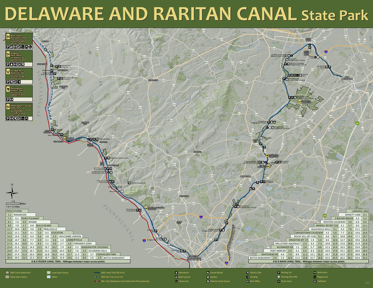
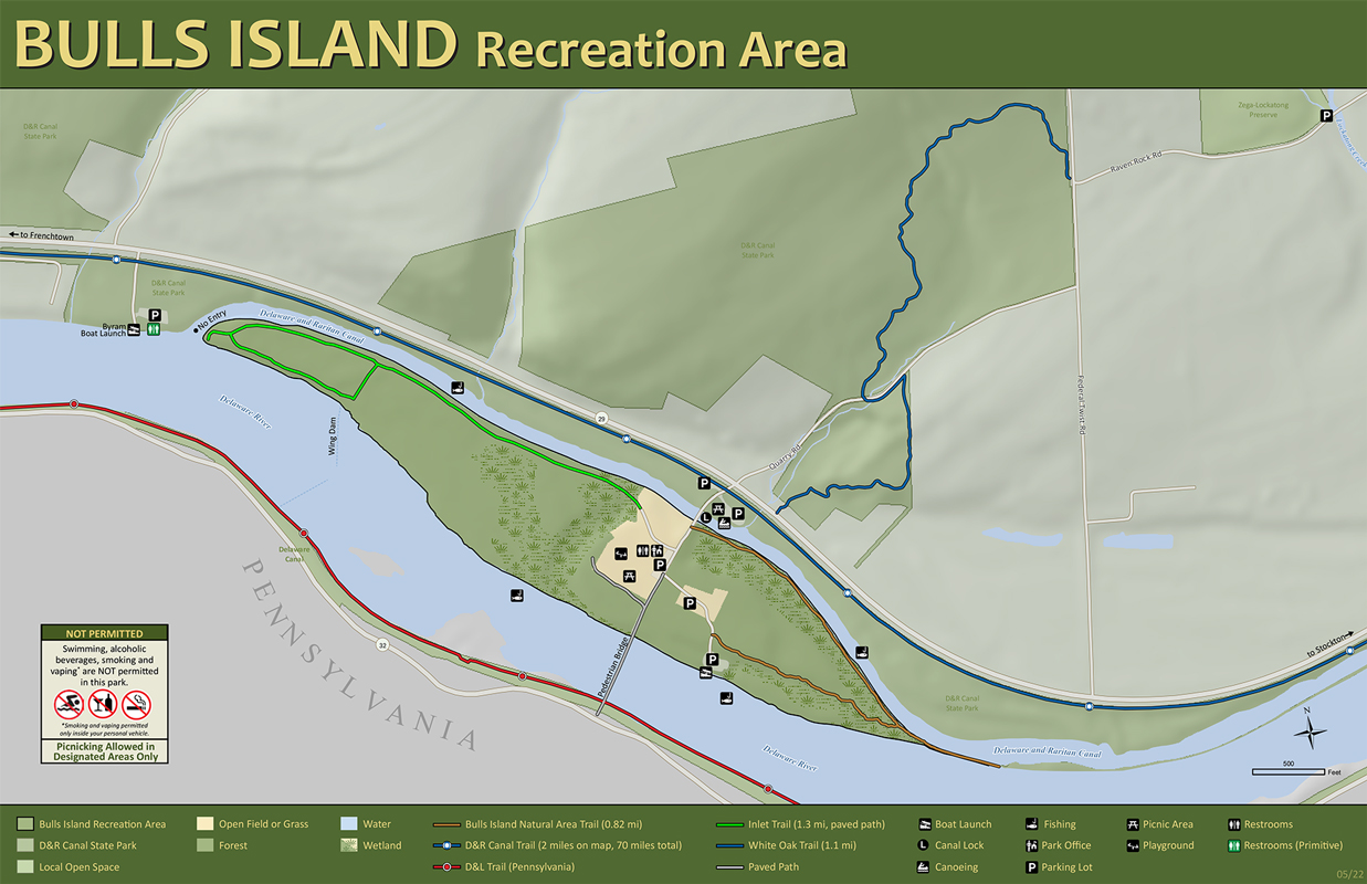
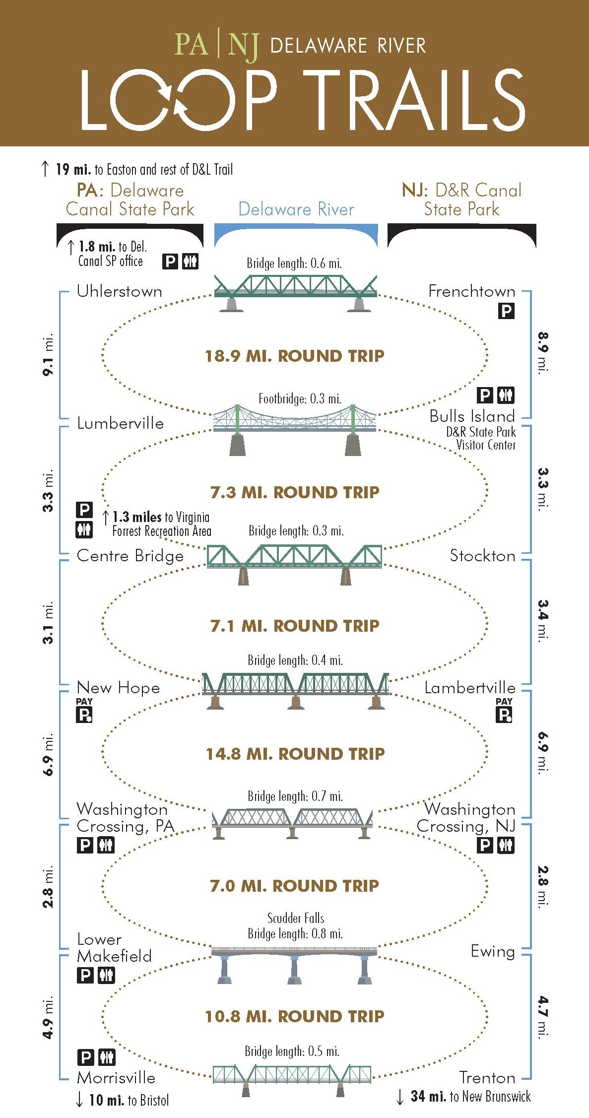
Bulls Island Recreation Area facilities include a park office with year-round restroom facilities, picnic area, boat launches into Delaware River and the D&R Canal and access to the Park’s linear multi-use trail along the river and Route 29. A pedestrian bridge over the river provides a connection to the Delaware Canal State Park in Pennsylvania and river loop trail. In addition to these amenities visitors can explore the Bulls Island Natural Area by hiking a mile-long trail leading through a lowland floodplain forest where ostrich ferns, sycamores and stately tulip poplars can be seen.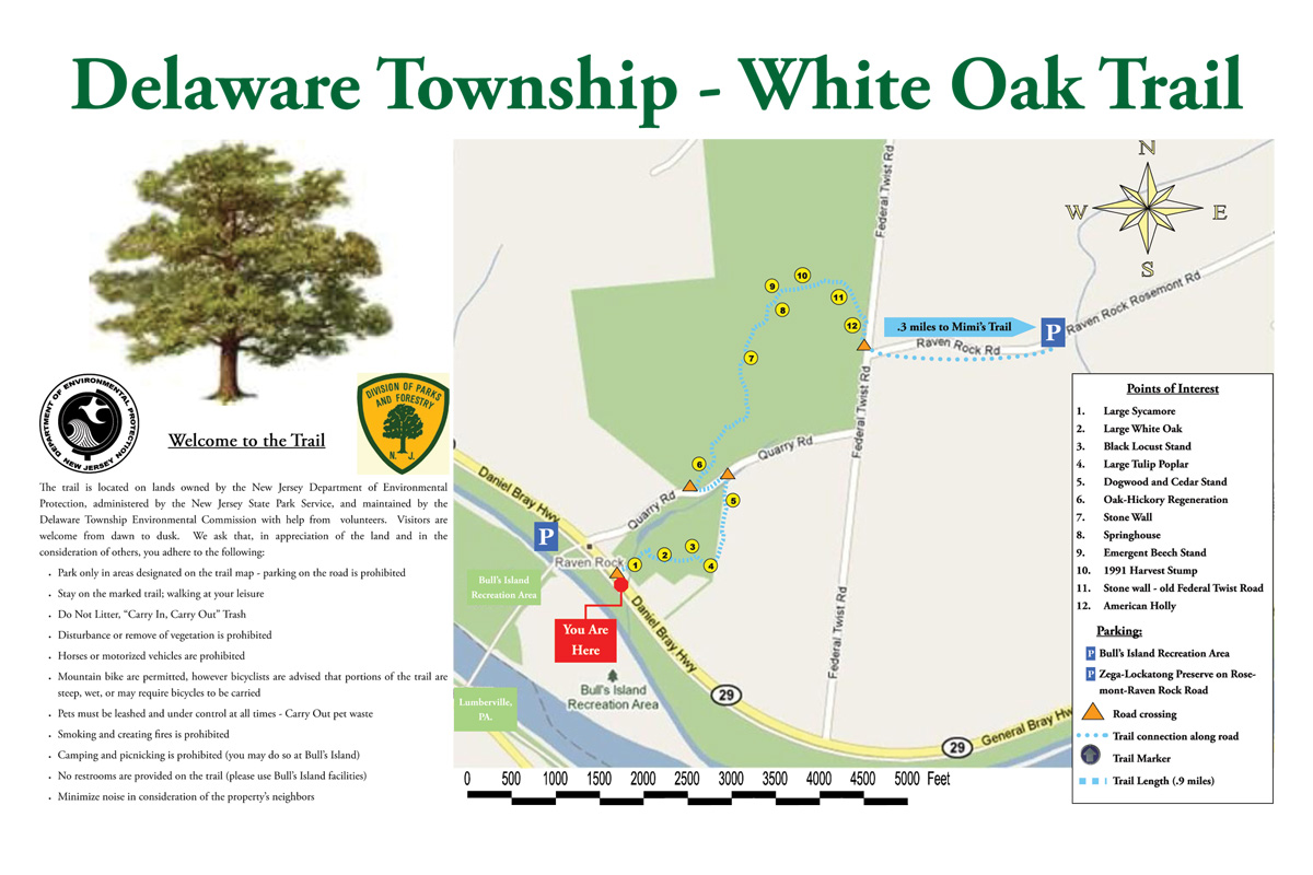
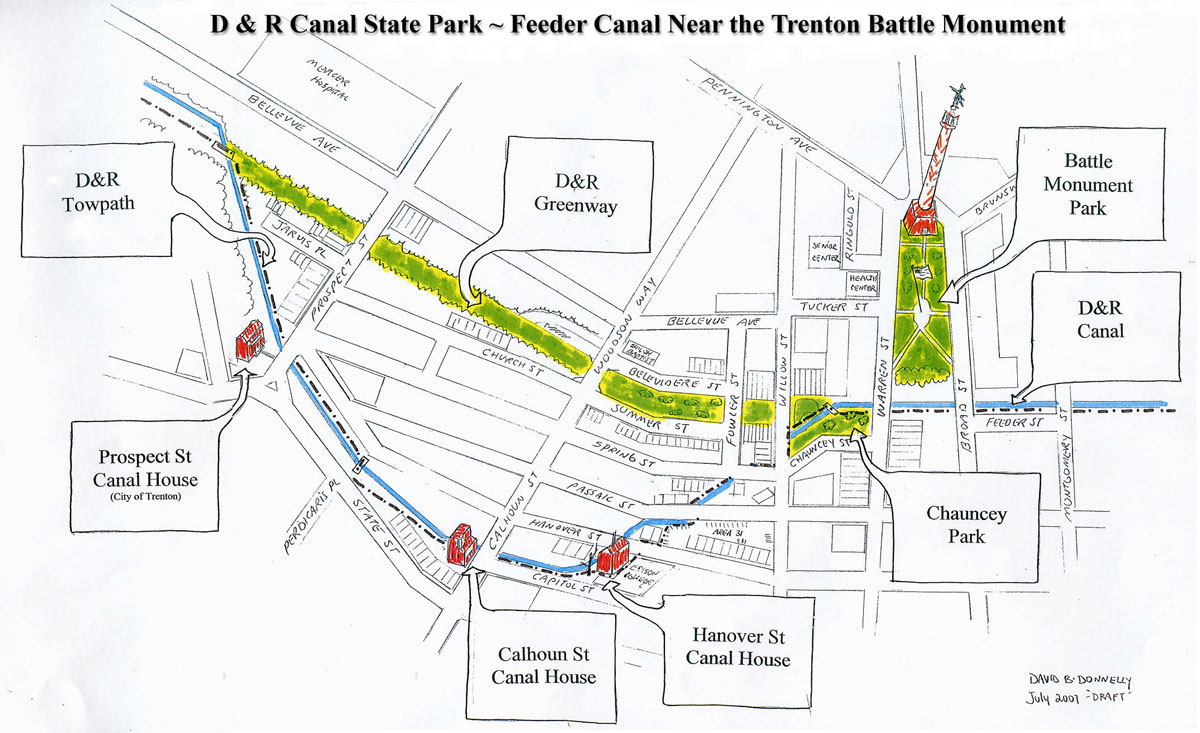
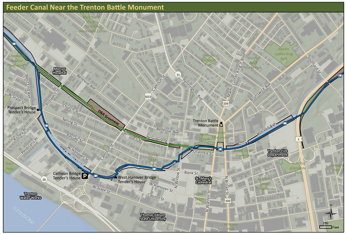
A section of the D&R Canal State Park passes through the City of Trenton, our State’s capital. This hand-drawn map highlights a detail of the city streets and historic canal houses that are located here. Park visitors have the option of following the historic canal path as it winds through the city or utilizing the D&R Greenway, the former railbed of the Belvidere-Delaware Railroad.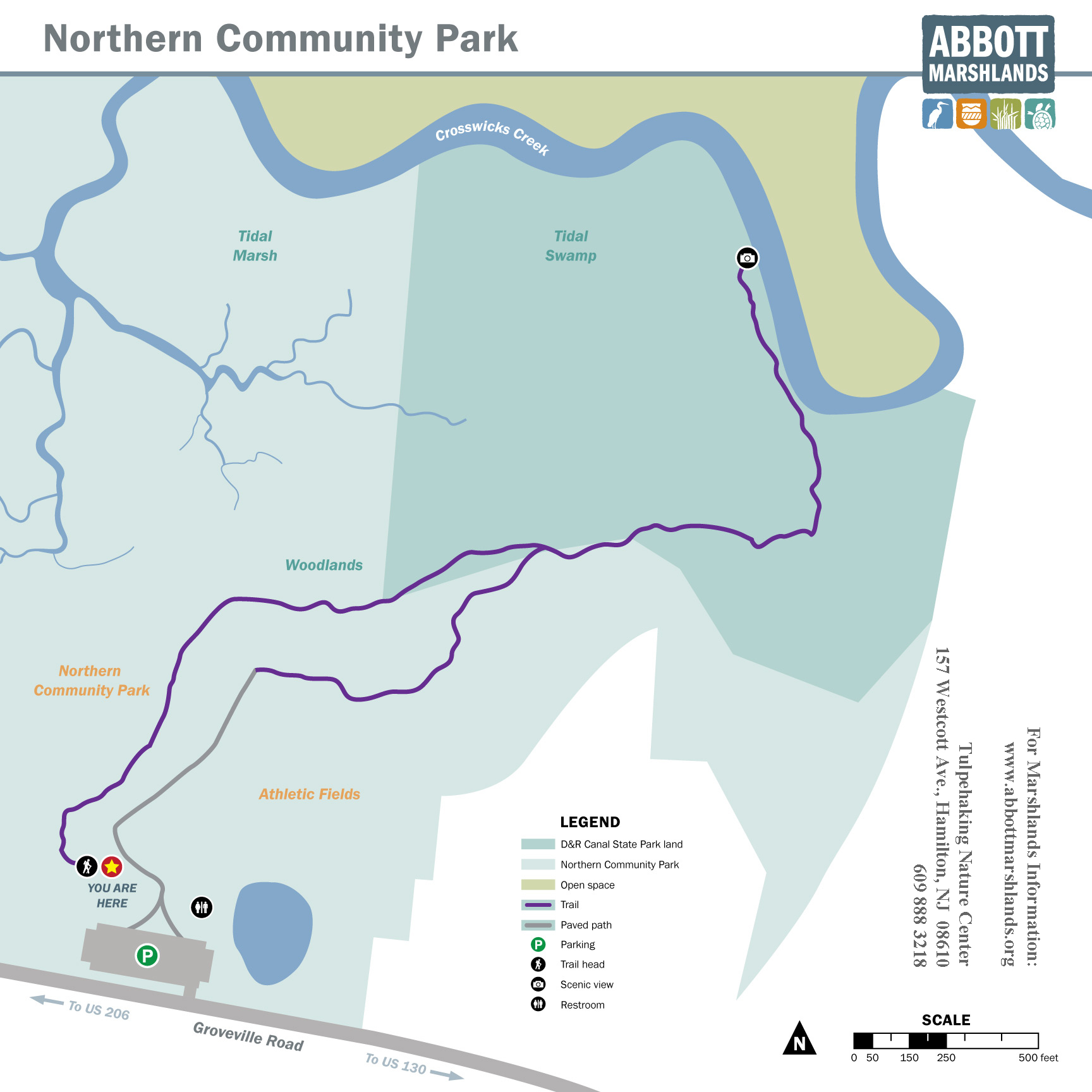
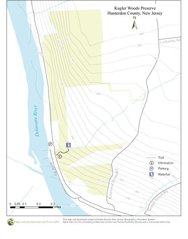
The Kuglar Woods area is located within the Delaware River Bluffs in Kingwood Township, Hunterdon County. At the present time there is ¼ mile trail leading to a beautiful three-season waterfall for the public to explore. To access the trail visitors can park on the southbound side of Route 29 near the highway marker 28 in Kingwood Township, Hunterdon County. The trail is located immediately south of the parking lot, visitors must cross Route 29 to access the trailhead. Please use extreme caution while crossing the roadway.
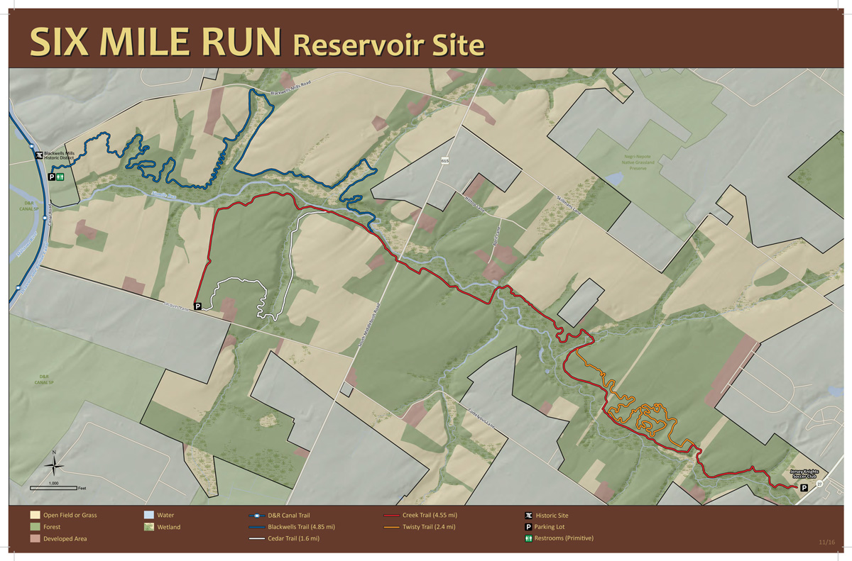
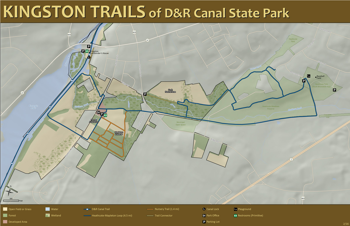
View/print/download high resolution map here.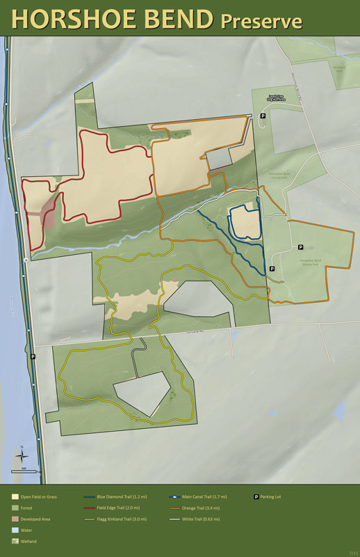
Hunting is allowed at this park during hunting season with a permit for population control Monday through Saturday; hunting is not permitted on Sundays. Hunting season typically lasts from September to February. Visitors should wear bright reflective vests for safety during hunting season. 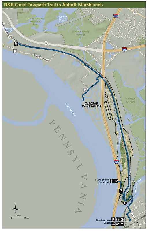
As you cross over the canal on the “king post” style wood pedestrian bridge, please take note of the remnants of the historic wooden lock. Here, at Lock 1, was the entrance to the D&R Canal for all boat traffic heading from Philadelphia via the Delaware River north to the outlet locks at New Brunswick on the Raritan River and further on to New York City (or exit for those heading from New York towards Philadelphia).